
The Antonine Wall was a huge defensive structure that run through the central belt of Scotland. It was built by the ancient Romans to mark the northwestern frontier of their empire.
The construction of the Wall was ordered by the Roman emperor Antoninus Pius (reign: 138-161) after his legions had conquered the southern region of present-day Scotland. Antoninus Pius, the adopted son of Emperor Hadrianus (reign: 117-138), was one of the ‘Five Good Emperors’ of the Nerva-Antonine Dynasty, alongside Nerva, Trajanus, Hadrianus, and Marcus Aurelius.
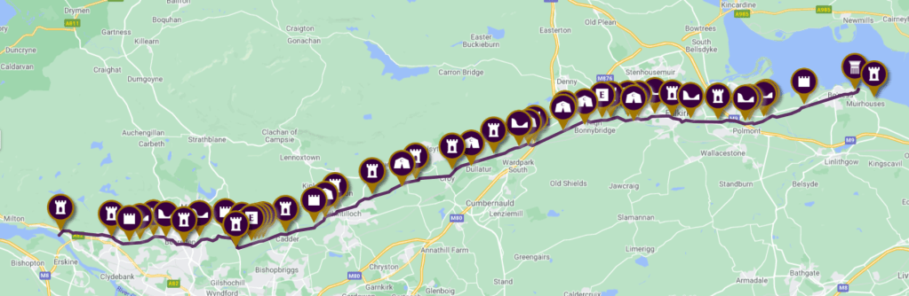
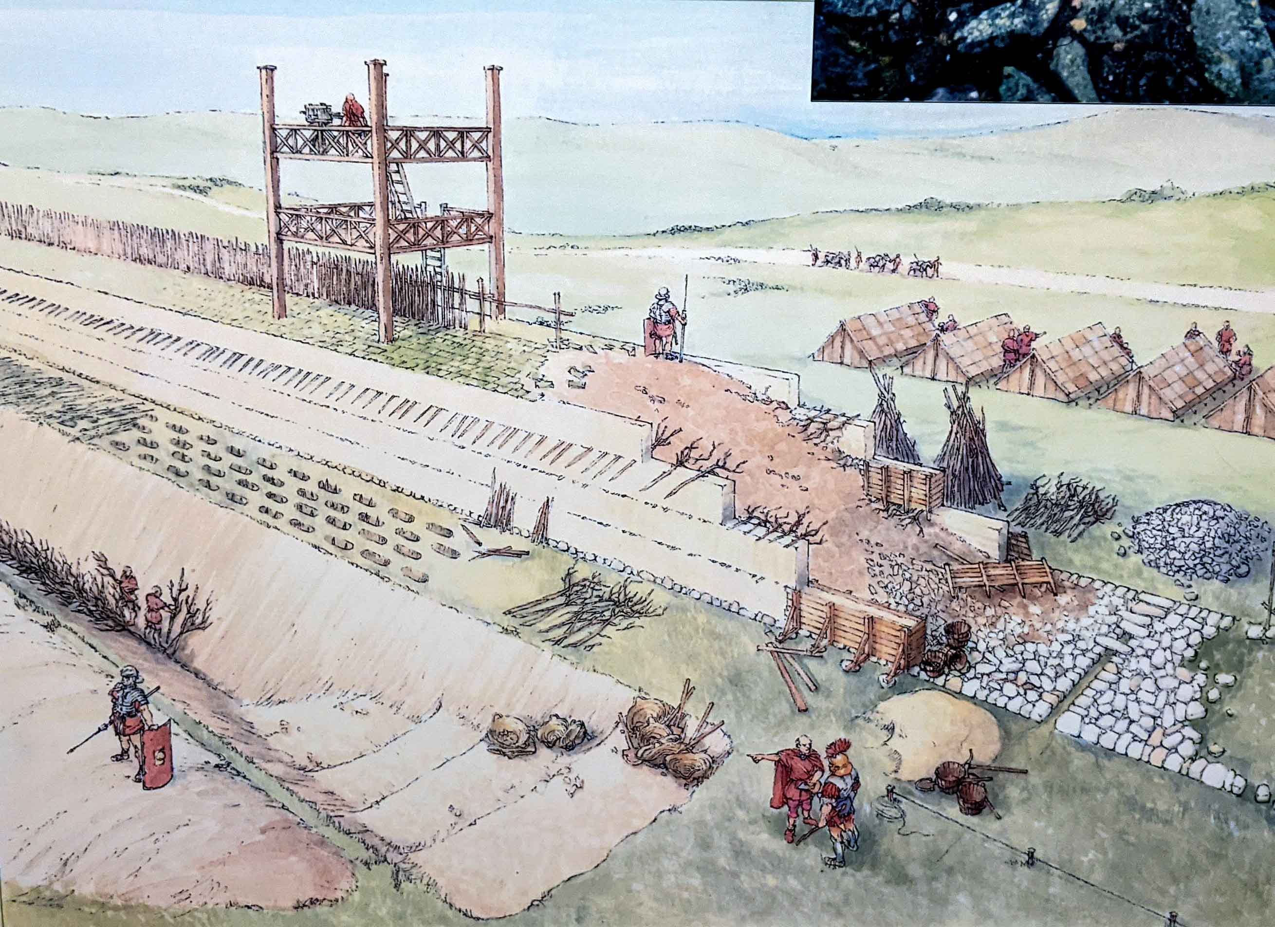
The construction of this massive undertaking began in 142 AD, two decades after the construction of Hadrian’s Wall, and it took 12 years to complete. The resulting wall stretched for 63 kilometers from Old Kilpatrick on the Firth of Clyde to Carriden on the Firth of Forth. The route strategically utilized landscape features such as ridges, crests, and escarpments to create a formidable barrier. The wall itself was primarily constructed of turf on a stone base, standing approximately 3 meters high and 4.3 meters wide. Running parallel to the rampart, a V-shaped ditch measuring 12 meters wide and 3.7 meters deep was dug, positioned 6 meters to the north. The excavated soil from the ditch was used to construct an outer mound known as the counterscarp on its north side. Additionally, nineteen forts were strategically positioned along the wall, serving as accommodation for border troops and facilitating crossing points. Despite its grand scale, the Antonine Wall was occupied for a relatively short period of about 20 years. It was eventually abandoned, leading to the empire’s border being relocated southward to its previous position at Hadrian’s Wall around 165 AD. The specific reasons for this withdrawal remain unknown.
This mighty symbol of the power and authority of the ancient Romans eventually fell into decay, resulting in the disappearance of numerous barriers, forts, and other military structures. Since 2008, the Antonine Wall has been designated as part of the Frontiers of the Roman Empire UNESCO World Heritage Site, alongside Hadrian’s Wall and the German Limes. Today, visitors can only explore the traces of ramparts, steep ditches, and the remains of forts and bath-houses. These archaeological remnants can still offer a glimpse into the lives of the Romans stationed on this remote frontier, allowing visitors to imagine what life was like in those times.
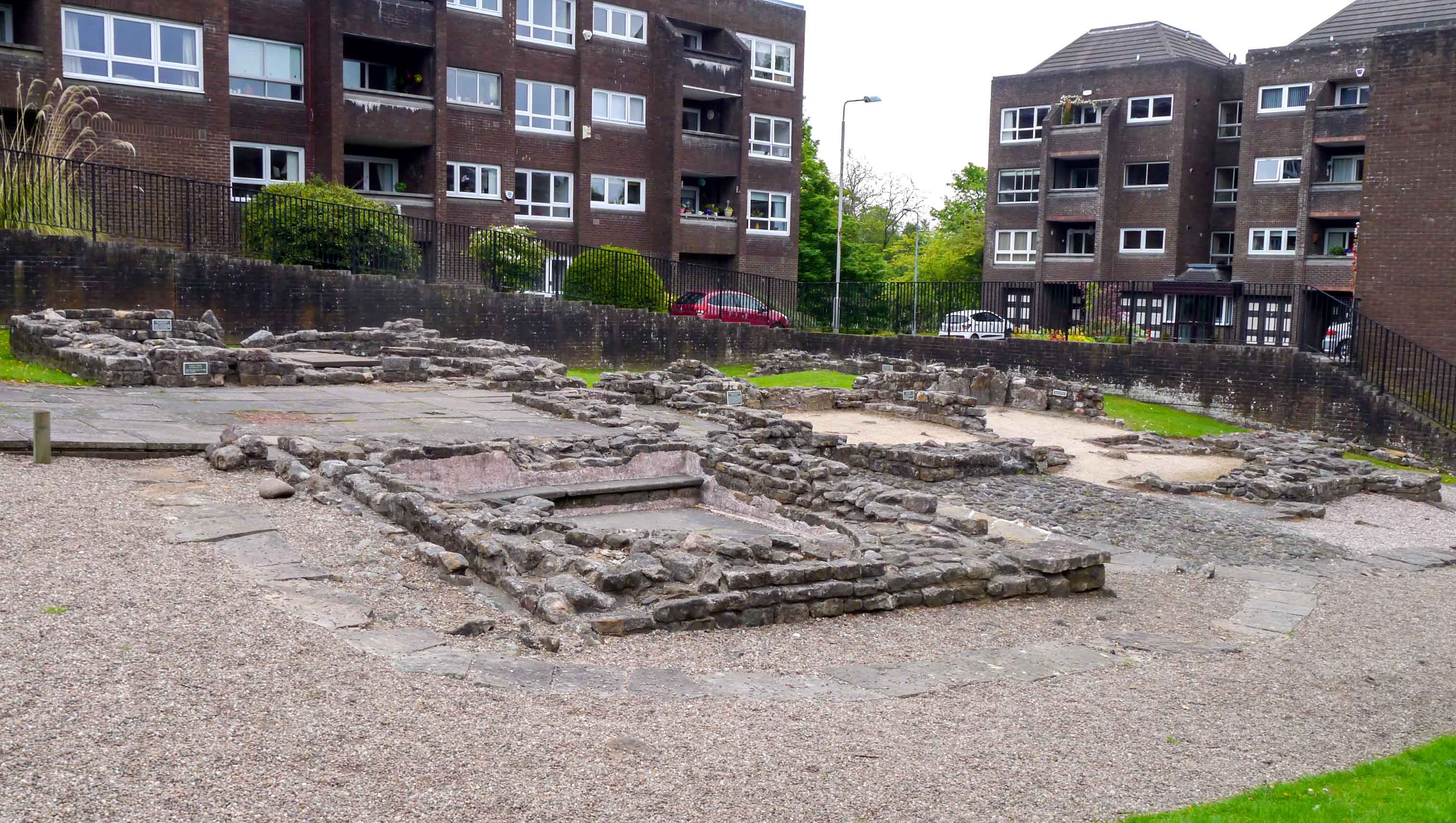
The Bearsden Bath-house stands as the finest example of stone structures along the entire Antonine Wall. The exposed remains of the bath-house and latrines are situated within a fortified annex of a fort that once occupied this site, although it is now mostly covered by houses and roads.
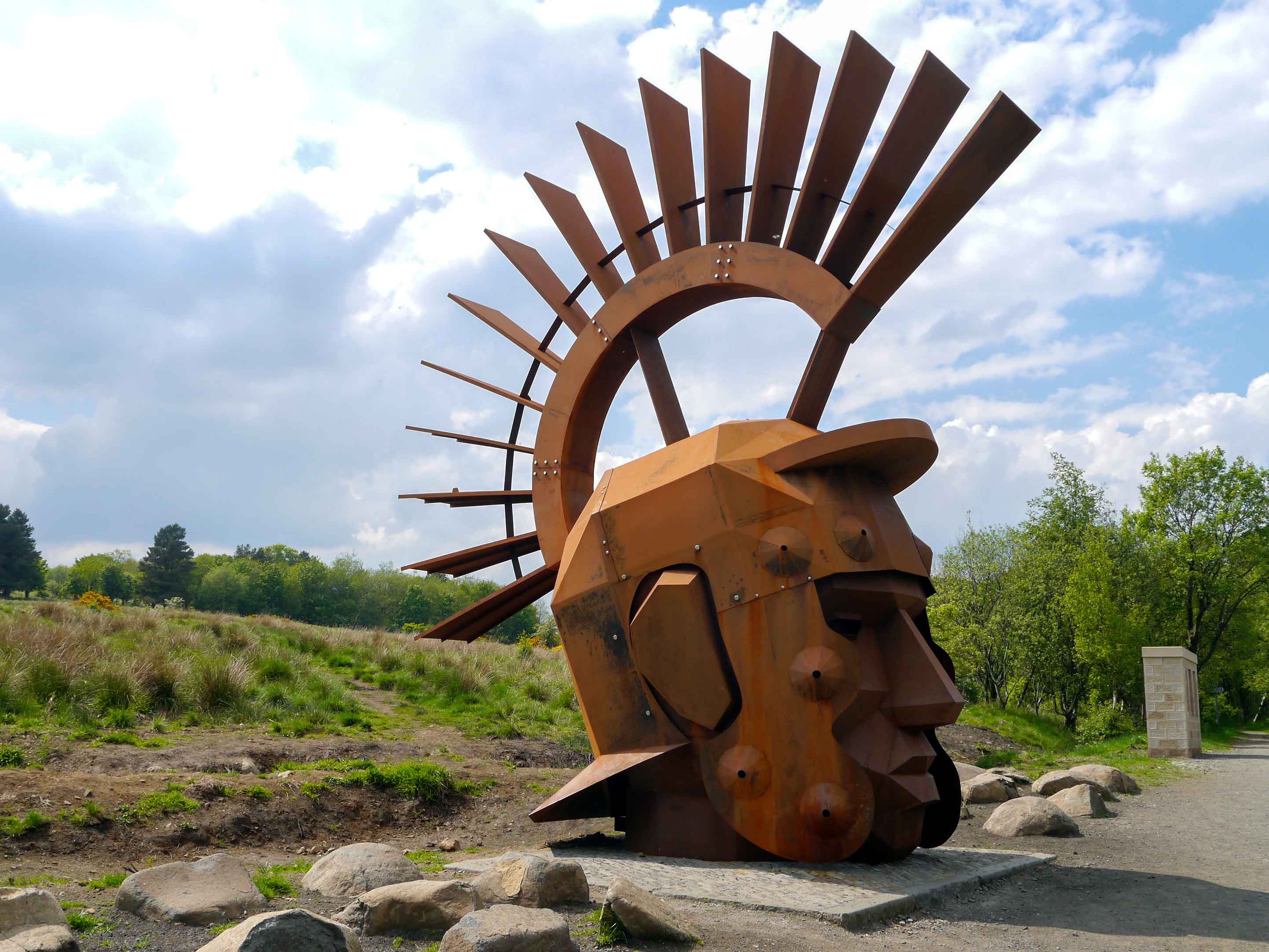
The Two Hill Forts Walk is a scenic route that follows the John Muir Way along the Antonine Wall from Twechar to Dullatur. This walk highlights three notable points of interest: Bar Hill, Castle Hill, and Croy Hill. Bar Hill stands out as the highest point along the wall, reaching an elevation of 250 meters and featuring preserved fort remains. Adjacent to Bar Hill, Castle Hill is the site of an Iron Age fort. Further along, Croy Hill also showcases excavated fort remains. This walk offers the best vantage points to appreciate the Antonine Wall within its broader landscape. The conclusion of this walk in Silanus is marked by a sculpture depicting the head of a Roman soldier, created by Svetlana Kondakova and Gordon Simpson. This imposing statue gazes out from the line of the Antonine Wall towards the Campsie Fells, a region historically considered a ‘barbarian’ territory beyond the borders of the Roman Empire. Alternatively, visitors can choose to return alongside the Forth and Clyde Canal to Twechar.
The Rough Castle boasts the best-preserved fort among the remains of the Antonine Wall. It also showcases the tallest surviving section of the wall’s rampart and features excellent ditch profiles. Moreover, the fort’s defense includes a remarkable feature known as lilia pits, which consist of a series of pits originally filled with sharpened stakes at the bottom. It is the only known example of such pits along the wall.
Callendar Park provides long open stretches of the Antonine Wall ditch, along with a museum housed within Callendar House. The exhibition, titled ‘The Antonine Wall, Rome’s Northern Frontier’, narrates the story of the Wall’s construction, among other interesting aspects.
While the Hunterian Museum of Glasgow is not situated directly on the line of the Antonin Wall, it remains an essential destination for those interested in the Wall and Roman Scotland in general. The museum houses the largest collection of artifacts related to the Antonine Wall, making it a must-visit for enthusiasts of Roman history.


Sources
https://www.antoninewall.org
