The island is famous for its dramatic landscape and is one of the most popular hiking destinations in Scotland.
Contents:
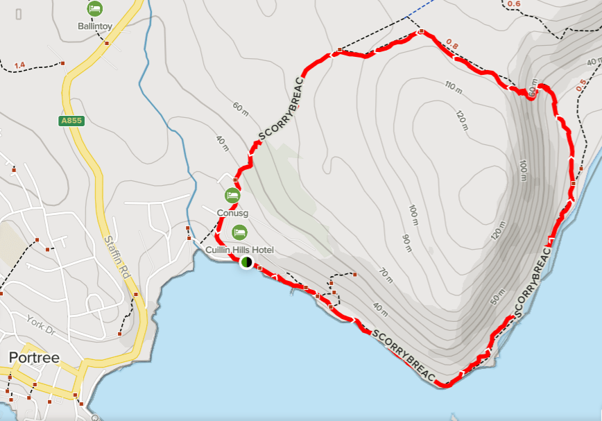
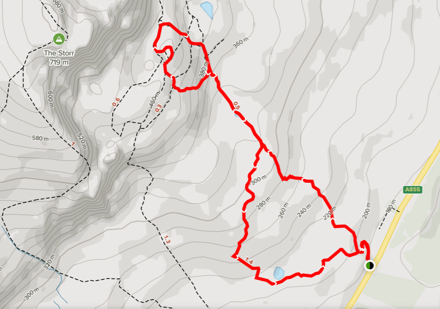
Portree and Scorrybreac Circuit Walk
The Old Man of Storr Hike and Coastal Walks
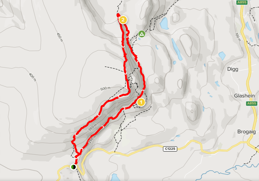
The Quiraing Hike
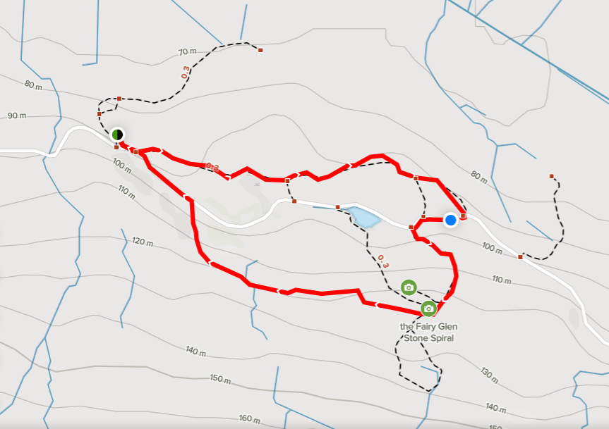
Fairy Glenn Walk
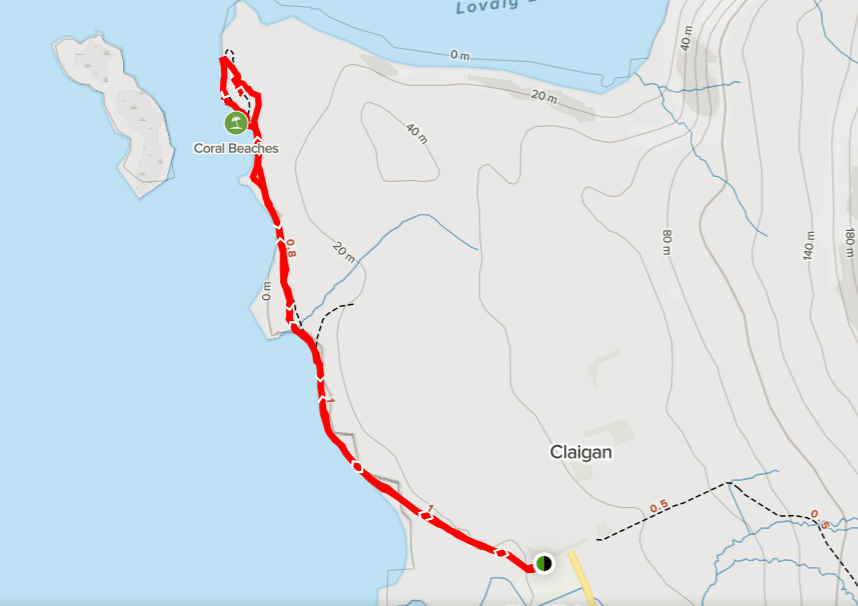
Dunvegan and Coral Beach Walk
Milovaig Coastal Hike with Neist Point Lighthouse Walk
Fairy Pools Hike
The Isle of Skye is renowned for its stunning scenery, showcasing a breathtaking combination of meandering mountain ranges, awe-inspiring rock formations, shimmering lochs, cascading waterfalls, and soaring sea cliffs. It is an exceptional destination for both walkers and climbers, with the Cuillin Range and the Trotternish Ridge offering exhilarating challenges. Moreover, the island presents abundant opportunities for observing wildlife, including red deer, sea eagles, otters, seals, dolphins, and whales. Additionally, Skye boasts a wealth of fossils from the Middle Jurassic period, which can be discovered in various coastal locations where sedimentary beds are exposed. Particularly captivating for visitors are the sites adorned with dinosaur footprints. Furthermore, the island holds a rich historical significance, serving as the ancestral seat of the MacLeod and MacDonald clans.
Capturing the island’s remarkable beauty may prove challenging as the relentless downpours and tempestuous winds make photographing a daunting task. Additionally, one must be well-prepared for the unpredictable weather, which can rapidly transform into an unfavorable and unpleasant experience all too frequently.
Portree and Scorrybreac Circuit Walk
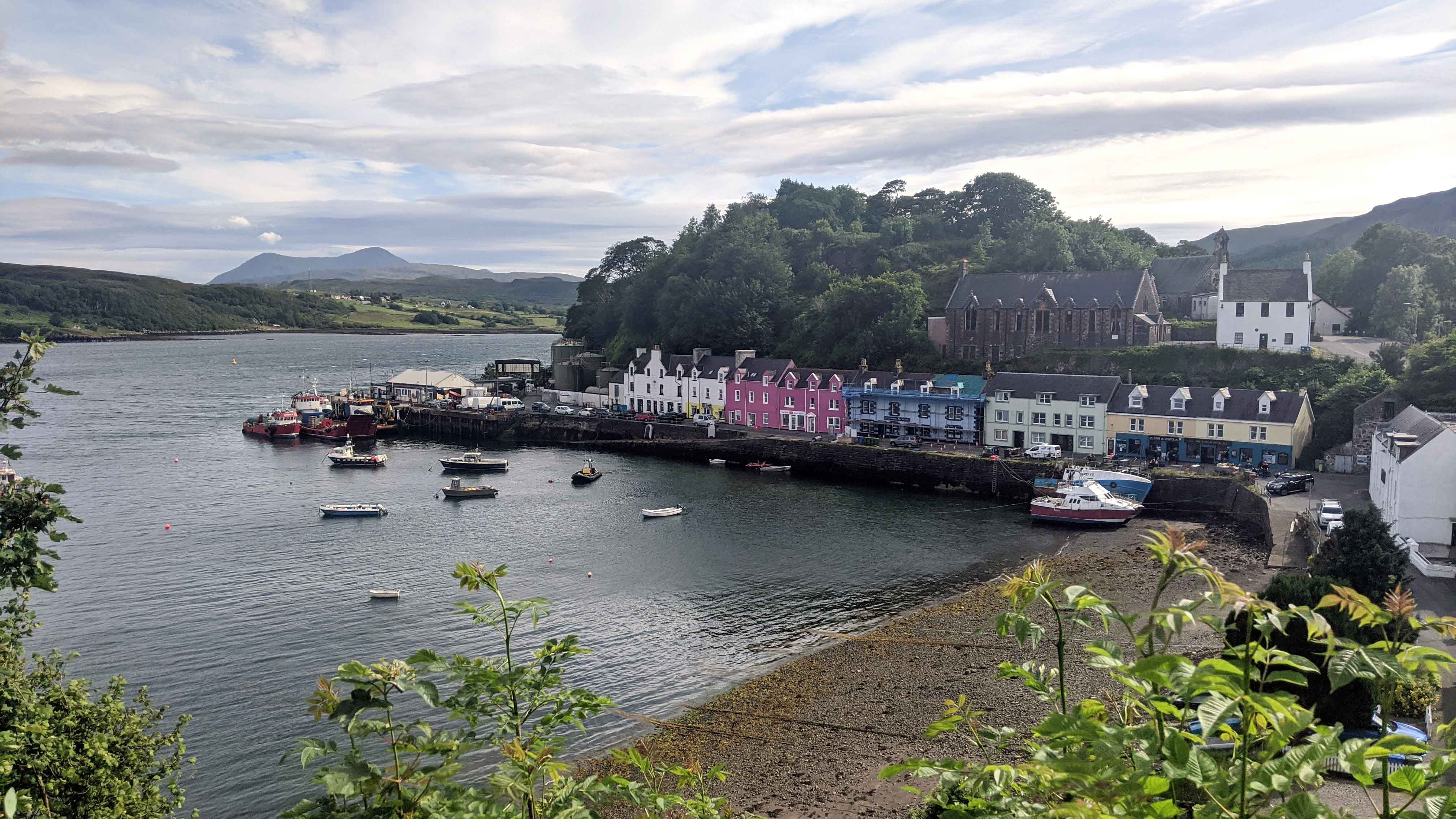
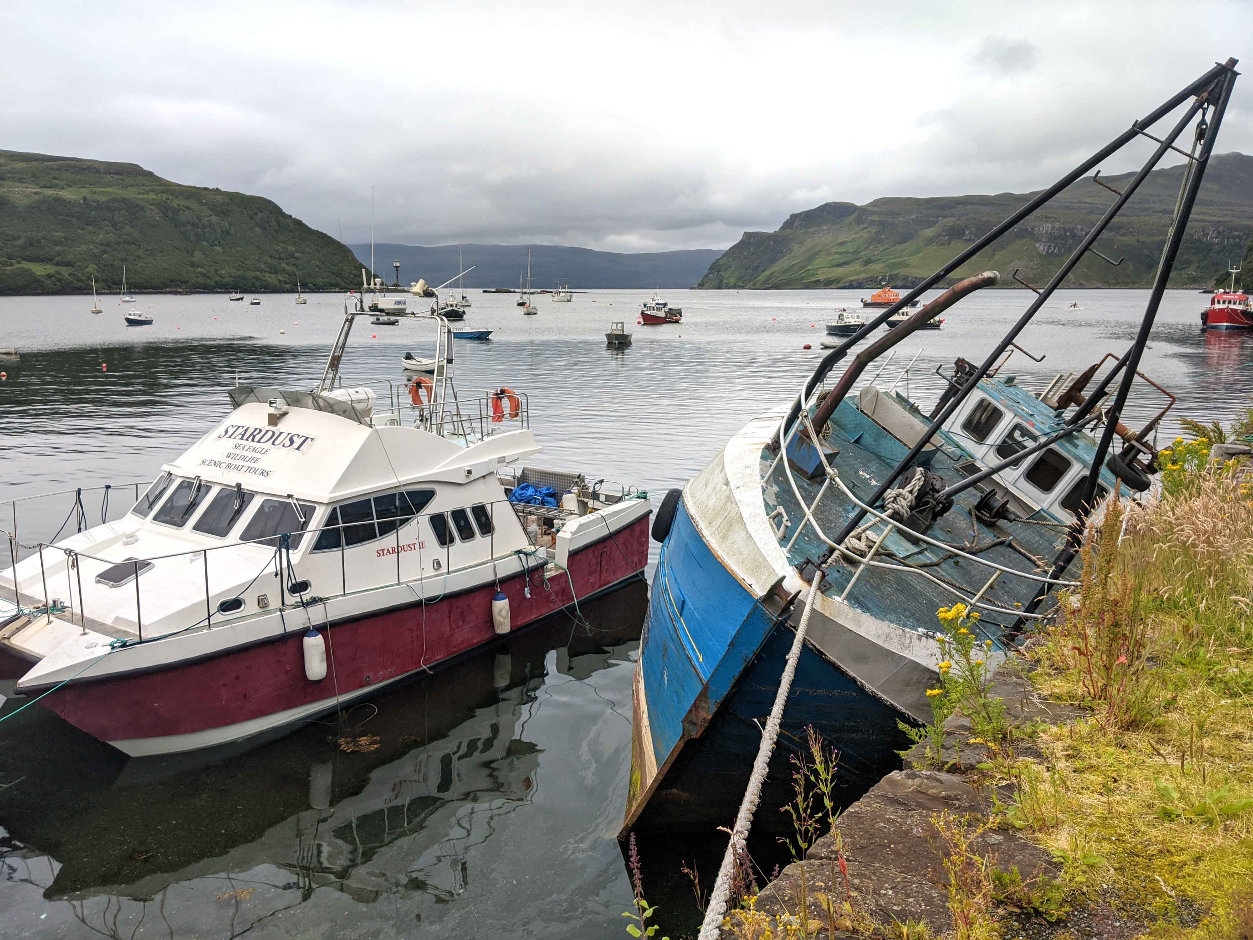
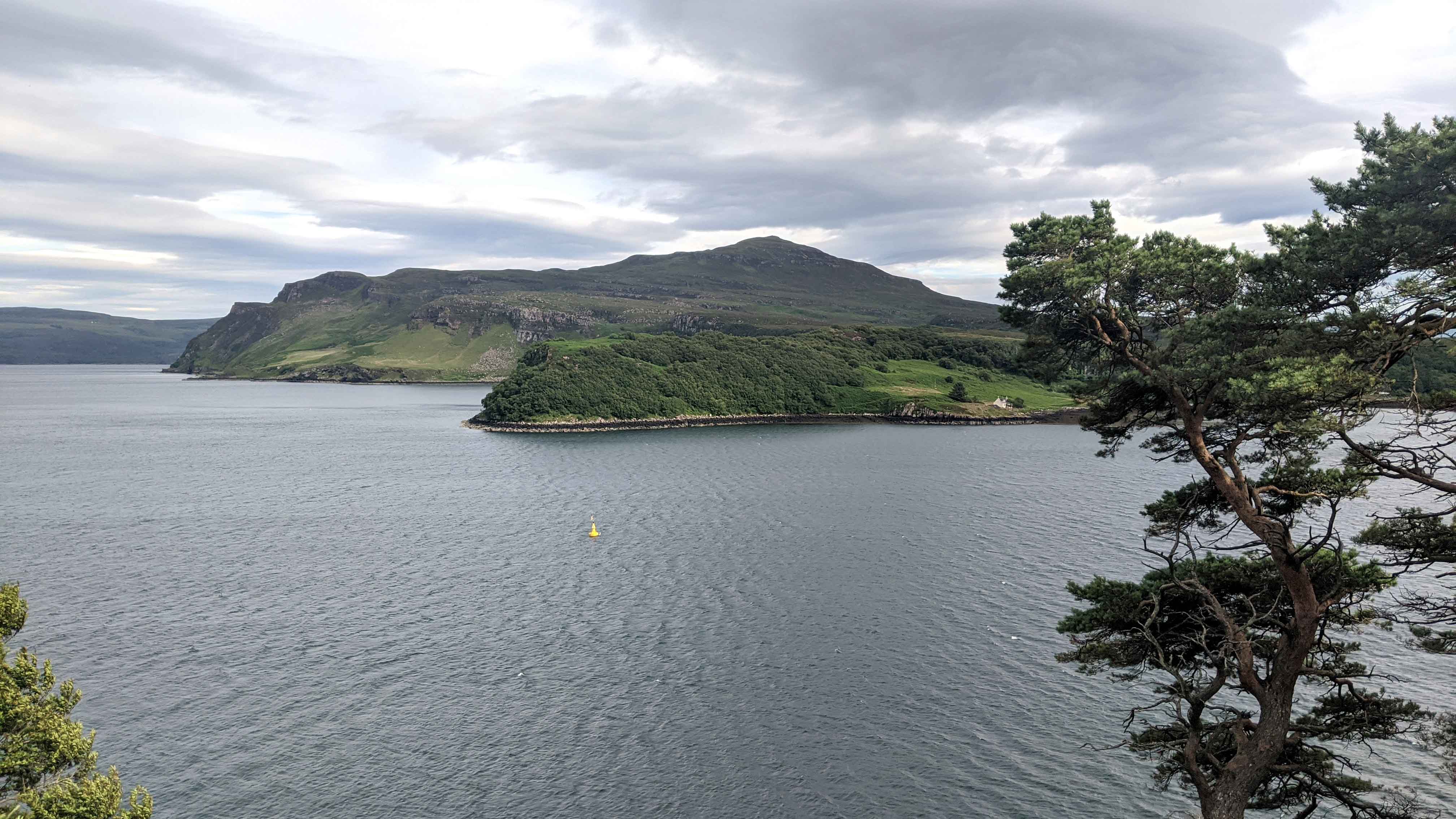
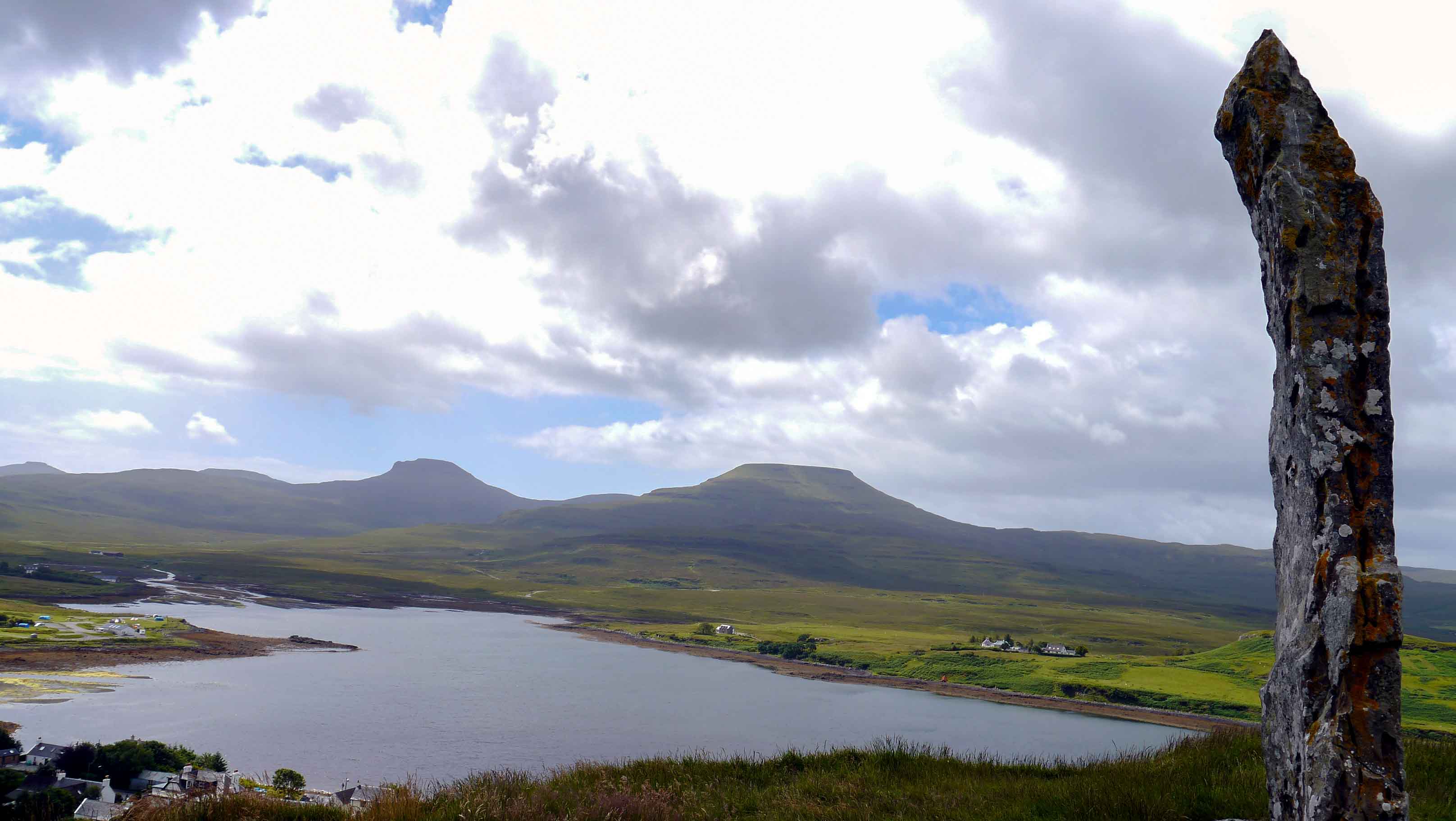
The village of Portree, the capital of the island, is a charming fishing village overlooking a sheltered bay.
The Scorrybreac Circuit Walk is a scenic trail that meanders along the shores of Portree Bay. This walk presents an opportunity to catch sight of the majestic Sea Eagles, which have made their nests on the towering cliffs.
Well defined paths throughout but the second half becomes more challenging with rough stones and a steep ascent.
Distance: 3 km
Ascent: 164 m
Duration: 1-2 hours
Info and map:
https://www.isleofskye.com/skye-guide/top-ten-skye-walks/scorrybreac
https://www.walkhighlands.co.uk/skye/scorrybreac.shtml
The Old Man of Storr Hike and Coastal Walks
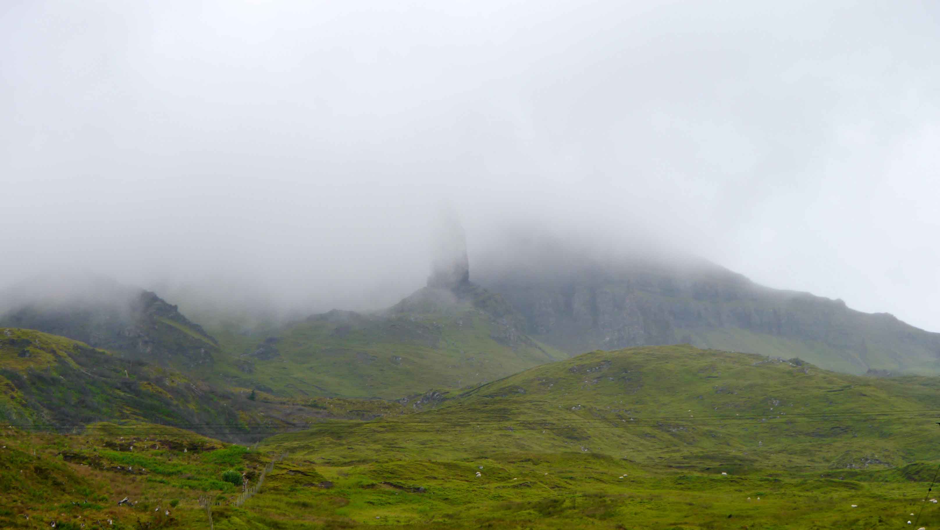
The Old Man of Storr Hike stands out as the island’s most renowned trail. Situated along the Trotternish ridge, the Storr itself was shaped by a great succession of ancient landslides.
The area in front of the Storr cliffs, encompassed by towering cliffs and pinnacles, is famously referred to as the Sanctuary. Among the notable rock formations, the most renowned is the ‘Old Man’, a prominent pinnacle visible from miles away. According to legend, the Old Man of Storr was a colossal giant who resided on the Trotternish Ridge. Upon his demise, his thumb, known as the ‘Old Man’, remained partially exposed above the ground. Adjacent to the Old Man is the Needle Rock, also known as the Cathedral, featuring a distinctive hole at its summit.
Clear hill paths with steep and rocky sections higher up.
Distance: 4.5 km
Ascent: 288 m
Duration: 1.5-2 hours
Info and map:
https://www.isleofskye.com/skye-guide/top-ten-skye-walks/old-man-of-storr
https://www.walkhighlands.co.uk/skye/old-man-of-storr.shtml
Continuing north along the coast, Rigg Viewpoint offers panoramic views of the Storr and its iconic pinnacle. Considered by many as the finest viewpoint in Scotland, it showcases magnificent sights encompassing the islands of Raasay, Rona, and Holm, the Trotternish Ridge, the Cuillin Hills, and the Scottish mainland.
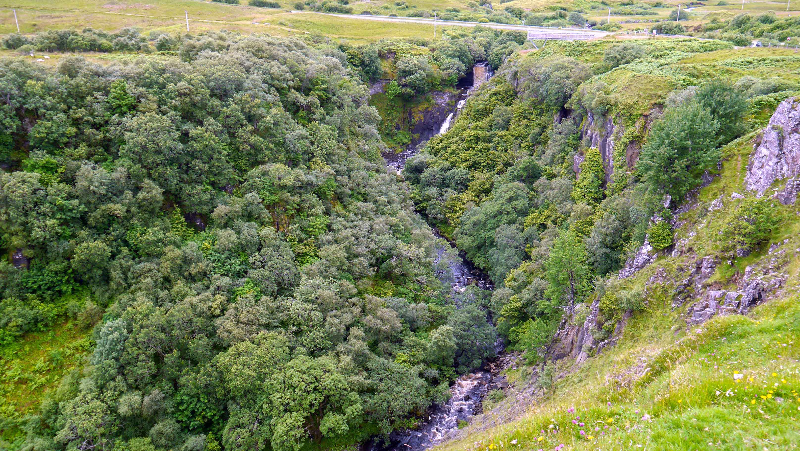
There are also two spectacular waterfalls on the east coast of the Trotternish Peninsula: Lealt and Mealt. At the first viewpoint of Lealt Falls, visitors can gaze deep into the canyon and witness the river finding its way down the rocks. Meanwhile, the second viewpoint provides a broader perspective of the cliffs and the expansive sea.
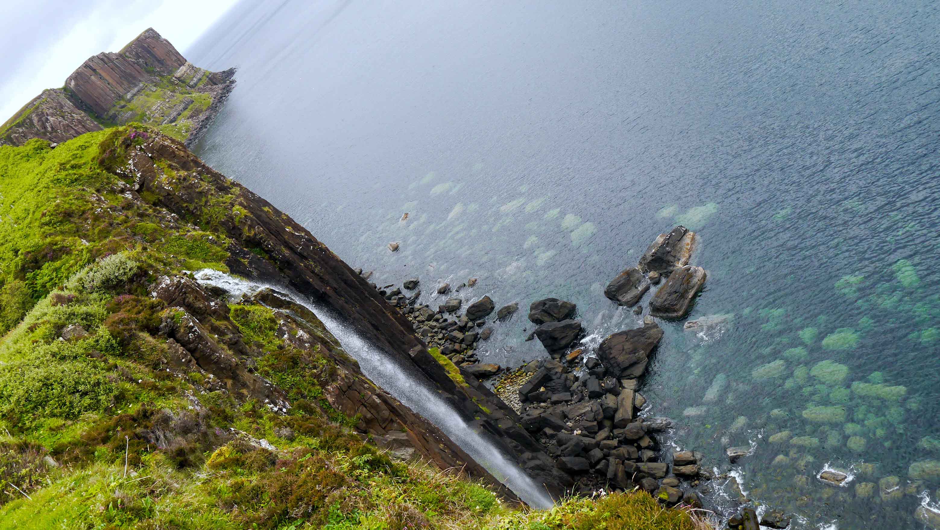
Just a few more kilometers north along the coast lies the remarkable Kilt Rock, accompanied by its magnificent waterfall, the Mealt Falls. The Kilt Rock boasts towering vertical basalt columns, reaching a height of 90 meters, resembling the pleats of a kilt, which inspired its name. Fed by the neighboring Mealt Loch, the waterfall plunges from the cliff’s edge, gracefully flowing over the columns until it meets the sandy coastline below.
The Quiraing Hike
The Quiraing Hike navigates through Scotland’s most spectacular landscape, featuring towering cliffs, secluded plateaus, and striking pinnacle rock formations. Situated along the Trotternish ridge, the Quiraing was shaped by a great sequence of ancient landslides, with this section being the only part that still experiences movement.
Certain rock formations along the trail have been assigned specific names. The initial formation encountered is known as the Prison, characterized by a pyramid-shaped rocky peak with three summits, resembling a medieval keep when viewed from a specific angle. Positioned directly above the Prison on the left side, within the primary landslip area, stands the Needle rock. It is the most prominent pinnacle among the group of sizable rock columns. Hidden from view beyond the Needle, the Table awaits, presenting a level expanse of grassy plateau encircled by sheer cliff faces. According to local folklore, the Table served as a sanctuary by locals, hiding their sheep and cattle from Viking raiders.
Initially, the path is good. However, as you progress, you will encounter rough and rocky sections, along with a minor ascent. The return route over the hill is exposed, and the final descent is very boggy and eroded.
Distance: 6.5 km
Ascent: 374 m
Duration: 3-4 hours
Info and map:
https://www.isleofskye.com/skye-guide/top-ten-skye-walks/the-quiraing
https://www.walkhighlands.co.uk/skye/quiraing.shtml
Fairy Glenn Walk
The Fairy Glenn Walk passes through an enchanting landscape adorned with grassy, cone-shaped hills interspersed with picturesque ponds and embellished with cascading waterfalls. The Fairy Glen was formed through a sequence of landslides, albeit on a smaller scale compared to the massive landslides that shaped the Storr and the Quiraing. Local folklore spins tales of fairies who allegedly created this petite realm, dwelling within its numerous concealed crevices.
While a suggested route exists, there is ample space for exploration and wandering. The most captivating vantage point can be found atop Castle Ewan, a natural rock formation that evokes the image of a weathered ancient ruin.
Mostly dry and grassy walk.
Distance: 2 km
Ascent: 45 m
Duration: 1 hours
Info and map:
https://www.walkhighlands.co.uk/skye/fairyglen.shtml
Dunvegan and Coral Beach Walk
The village of Dunvegan is renowned for Dunvegan Castle, the ancestral seat of the Clan MacLeod. The castle is situated on a rocky summit that was until recently encircled by the sea. The oldest section of the castle, known as the Keep, dates back to the 13th century. Subsequently, the castle underwent incremental expansions over the centuries. Lastly, in the 19th century, the entire structure was remodeled in a mock-medieval style. The Castle houses several noteworthy family heirlooms, including the Fairy Flag, the Dunvegan Cup, and Sir Rory Mor’s Horn.
The Fairy Flag holds numerous traditions surrounding its enigmatic origins and mystical qualities. According to several legends, the origin of the flag varies from a gift from the fairies to an infant chieftain, to a gift to a chief from a departing fairy-lover, or even a reward for defeating an evil spirit. One popular belief is that the flag possesses the power to protect and bring good fortune to the clan. It is said that whenever the flag was unfurled in times of danger or conflict, it provided supernatural assistance to the clan, multiplying their military forces and saving the lives of certain clan members. Another belief is that the flag is associated with fertility and aiding in childbirth. Women who sought the flag’s blessing would keep it near them during pregnancy or labor, hoping for a safe and successful birth. The Fairy Flag is also attributed with other powers, such as the ability to cure a plague on cattle and the ability to bring herring into the loch at Dunvegan. These various legends and powers have contributed to the mystical aura and reverence surrounding the Fairy Flag of the Clan MacLeod.
The Dunvegan Cup is a wooden ceremonial cup, decorated with beautifully crafted silver plates, which dates back to 1493. The cup has a square shape at the top and is rounded at the bottom, standing on four legs. Walter Scott, in his 1815 narrative poem ‘The Lord of the Isles’, describes this piece of antiquity as one of the greatest curiosities in Scotland: “A Hebridean drinking cup, of the most ancient and curious workmanship, has been long preserved in the castle of Dunvegan, in Skye, the romantic seat of Mac-Leod of Mac-Leod, the chief of that ancient and powerful clan.”
Sir Rory Mor’s Horn is a unique drinking horn, crafted from an ox’s horn and adorned with a silver tip. The horn features an intricate design with seven medallions encircling the rim near the mouthpiece. Three of the medallions depict beasts, while three others showcase decorative patterns. The seventh medallion combines both a pattern and a beast. According to the clan’s tradition, each successive chieftain was required to drink a full measure of wine from the horn as a symbolic gesture of their worthiness. This tradition served as a way to demonstrate the chieftain’s strength and authority within the Clan MacLeod.
The most popular activity on the estate is taking a boat trip to observe the seal colony residing in Loch Dunvegan.
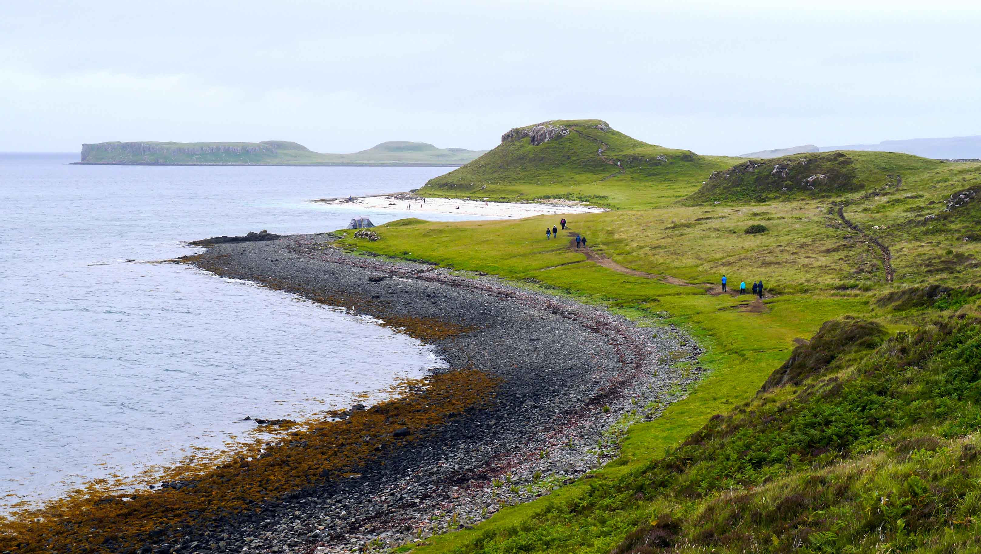
The nearby Coral Beach Walk leads to a unique beach along Loch Dunvegan, featuring a shoreline composed of bleached skeletons of Red Coralline seaweed, commonly referred to as maërl.
Good track.
Distance: 4 km
Ascent: 90 m
Duration: 1-2 hours
Info and map:
https://www.isleofskye.com/skye-guide/top-ten-skye-walks/coral-beach
https://www.walkhighlands.co.uk/skye/coralbeaches.shtml

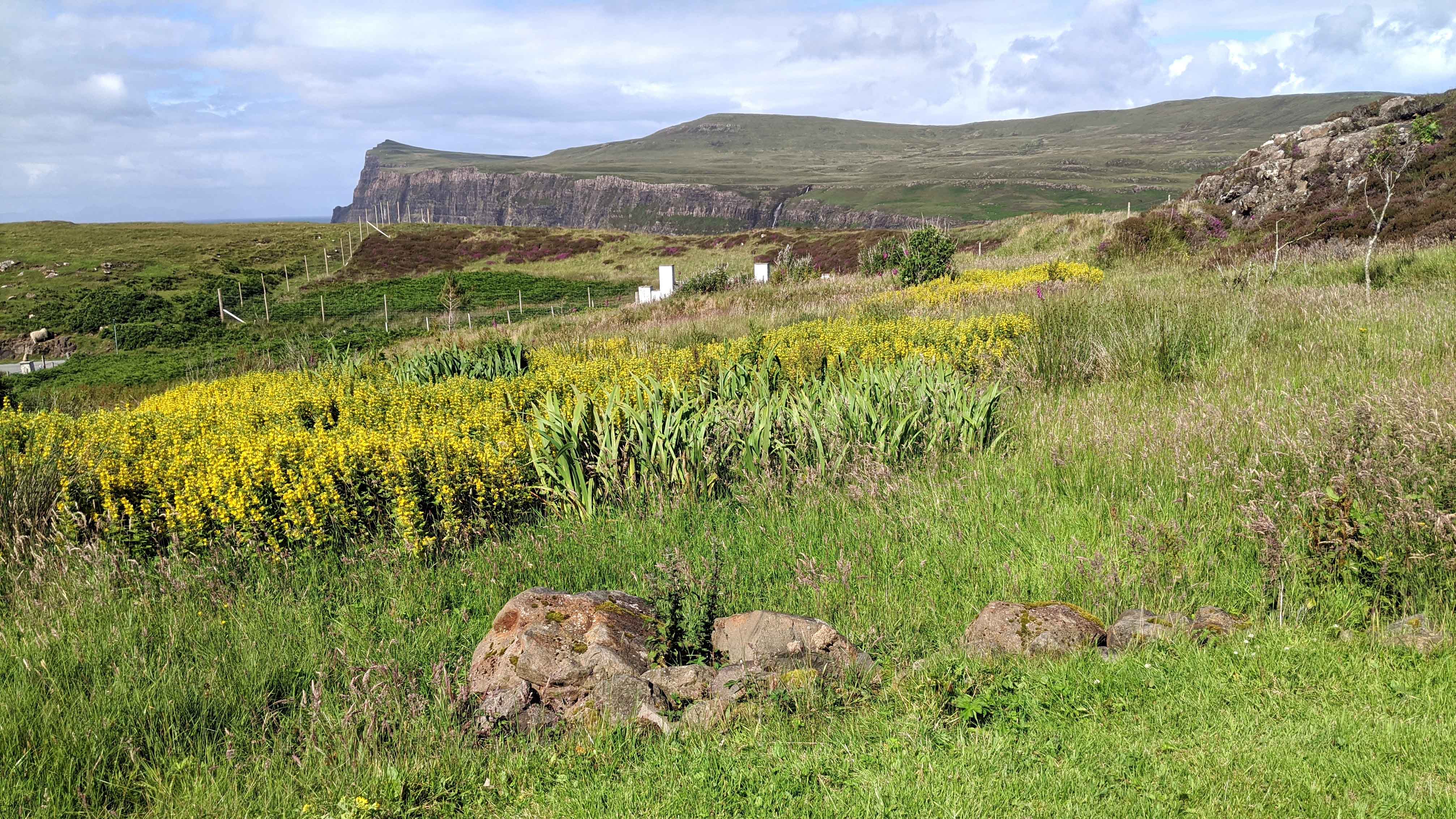
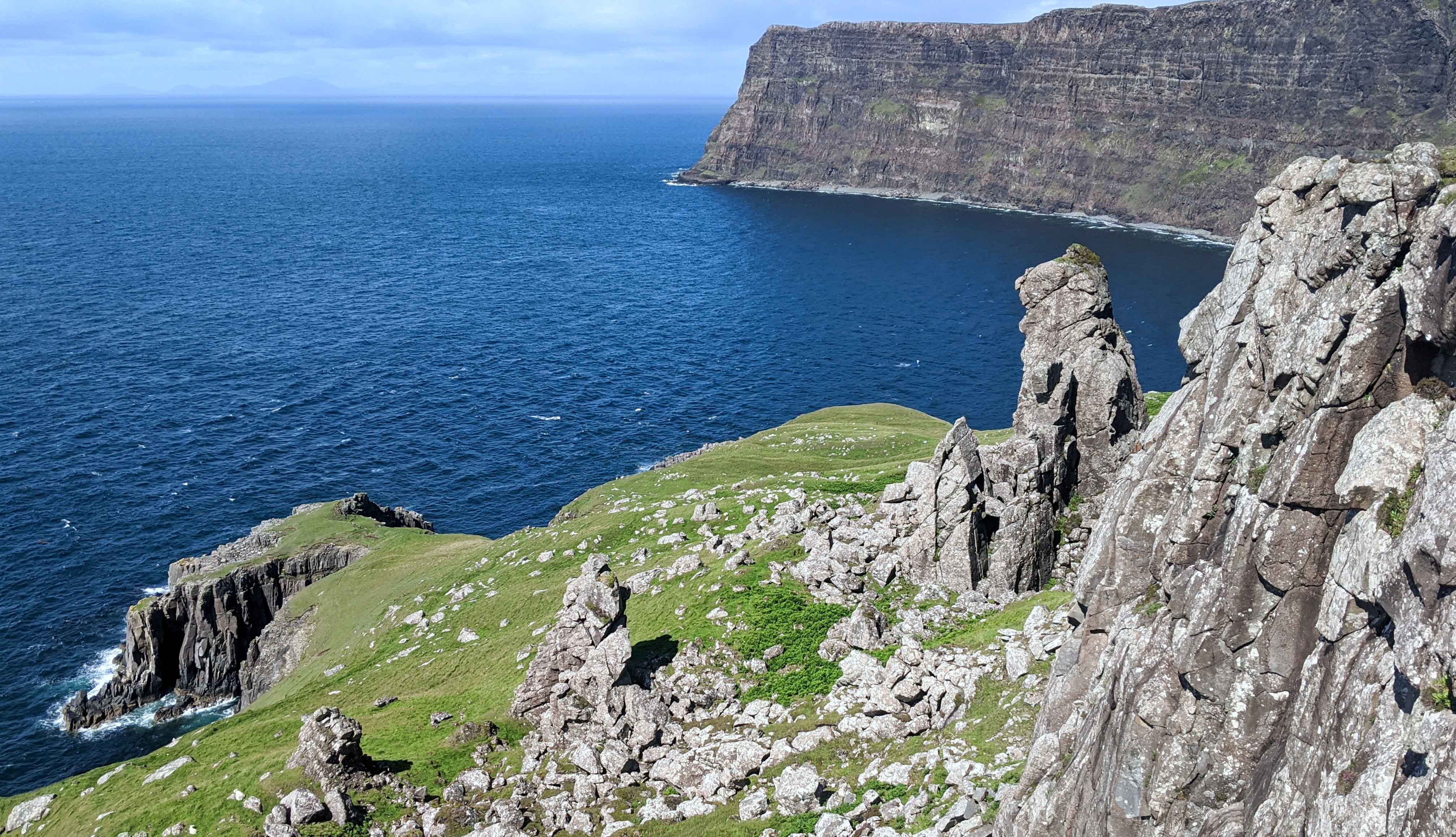
Milovaig Coastal Hike with Neist Point Lighthouse Walk
The Milovaig Coastal Hike winds along the dramatic coastal cliffs of the Duirnish Peninsula, offering breathtaking views of the surrounding scenery. The walk also provides great vistas of the islands of the Outer Hebrides, adding to the allure of the hike.
The path is without a defined trail, consisting of stretches of turf for long distances with some sections being very boggy. The return journey is made via a minor road.
Distance: 11 km
Ascent: 351 m
Duration: 3-5 hours
Info and map:
https://www.walkhighlands.co.uk/skye/milovaig.shtml
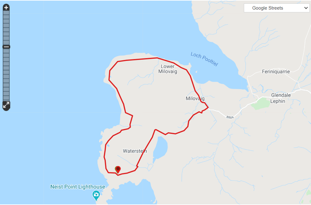
The Neist Point Lighthouse Walk is a natural extension of the Milovaig Coastal Hike, seamlessly continuing the exploration of the stunning coastal landscape.
Concrete path with steps.
Distance: 3 km
Ascent: 142 m
Duration: 1-2 hours
Info and map:
https://www.isleofskye.com/skye-guide/top-ten-skye-walks/neist-point-lighthouse
https://www.walkhighlands.co.uk/skye/neistpoint.shtml


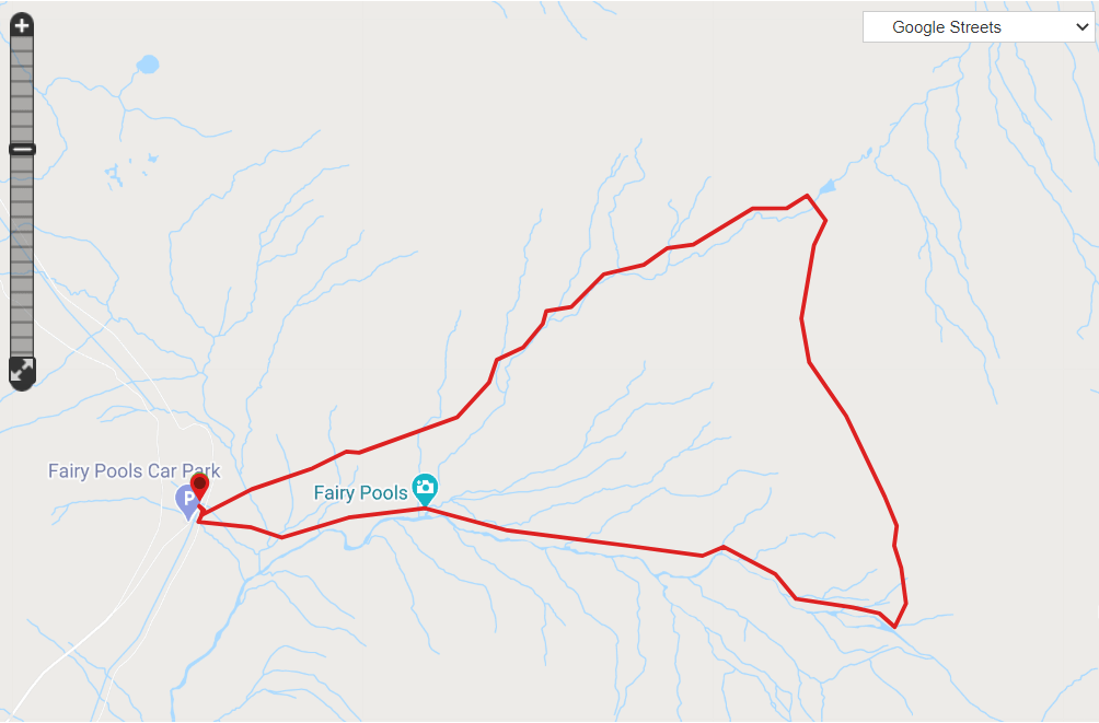
Fairy Pools Hike
The Fairy Pools Hike provides access to the quintessential landscape of the Cuillin Mountains without requiring challenging uphill climbs.
The initial section of the hike follows a pristine stream adorned with charming pools and cascades of diverse shapes and sizes, making it the most frequented part of the trail. As the path continues, it ventures into lesser-visited areas that are equally captivating in their picturesque beauty.
A winding path with occasional boggy sections and river crossings on stepping-stones.
Distance: 8 km
Ascent: 360 m
Duration: 2.5-3.5 hours
Info and map:
https://www.isleofskye.com/skye-guide/top-ten-skye-walks/fairy-pools
https://www.walkhighlands.co.uk/skye/fairypools.shtml
Sources
https://www.isleofskye.com
https://www.walkhighlands.co.uk/skye
https://www.dunvegancastle.com
